Resultados del análisis
La IA seleccionó las ubicaciones más probables según la imagen, los detalles visibles y las pistas contextuales.
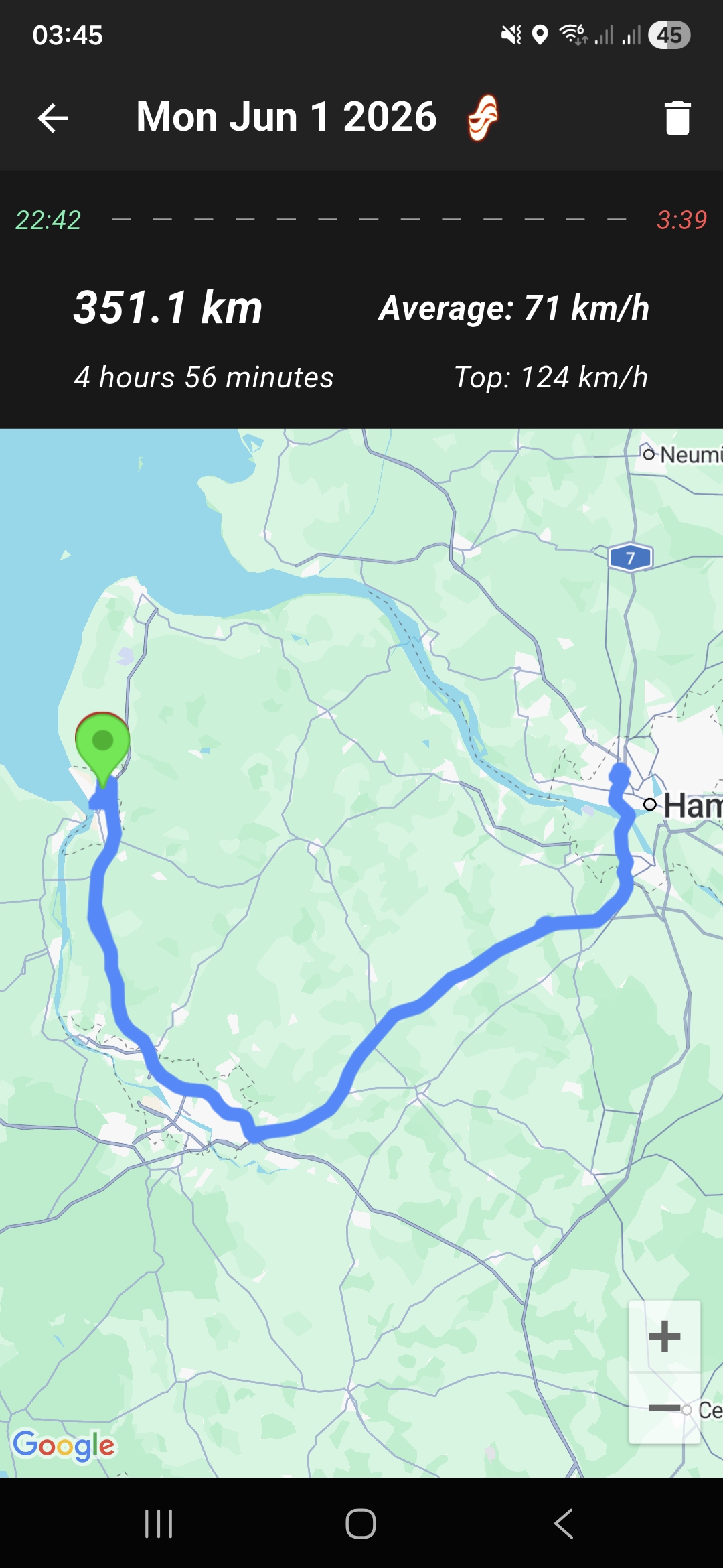
The route starts near Hamburg and heads northwest to the coast, ending near a large water body consistent with the Jade Bight bay on the North Sea coast. The endpoint is near Wilhelmshaven, a major port city on the German North Sea coast.
The distance of 351.1 km and travel time of nearly 5 hours at an average speed of 71 km/h fits the driving distance from Hamburg to Wilhelmshaven. The endpoint is near the Friesland district, which is adjacent to Wilhelmshaven and also borders the North Sea.
The route and distance fit this area as well, but it is less precise than pinpointing Wilhelmshaven city itself. Cuxhaven is another major coastal city on the North Sea in Lower Saxony, northeast of Wilhelmshaven.
The distance is slightly longer from Hamburg but still plausible for a 5-hour trip. This is a less likely endpoint compared to Wilhelmshaven based on the route shape but remains a possible alternative coastal destination.
The endpoint is near the Friesland district, which is adjacent to Wilhelmshaven and also borders the North Sea. The route and distance fit this area as well, but it is less precise than pinpointing Wilhelmshaven city itself.
Cuxhaven is another major coastal city on the North Sea in Lower Saxony, northeast of Wilhelmshaven. The distance is slightly longer from Hamburg but still plausible for a 5-hour trip. This is a less likely endpoint compared to Wilhelmshaven based on the route shape but remains a possible alternative coastal destination.
🗺 En el mapa
 высокая уверенность
•
высокая уверенность
•
 средняя
•
средняя
•
 низкая
Cómo llegó la IA a esta conclusión
Entorno
Coastal area near the North Sea • Mixed rural and urban greenery • Temperate maritime • Coastal lowlands • Rural farmland and coastal marshes • Coastal area on the North Sea • Coastal and urban
Infraestructura
European style roads • None visible • Not visible
Texto y señales visibles
Mon Jun 1 2026 • 351.1 km • Average: 71 km/h • 4 hours 56 minutes • Top: 124 km/h
Contexto y cultura
Not visible