Resultados del análisis
La IA seleccionó las ubicaciones más probables según la imagen, los detalles visibles y las pistas contextuales.
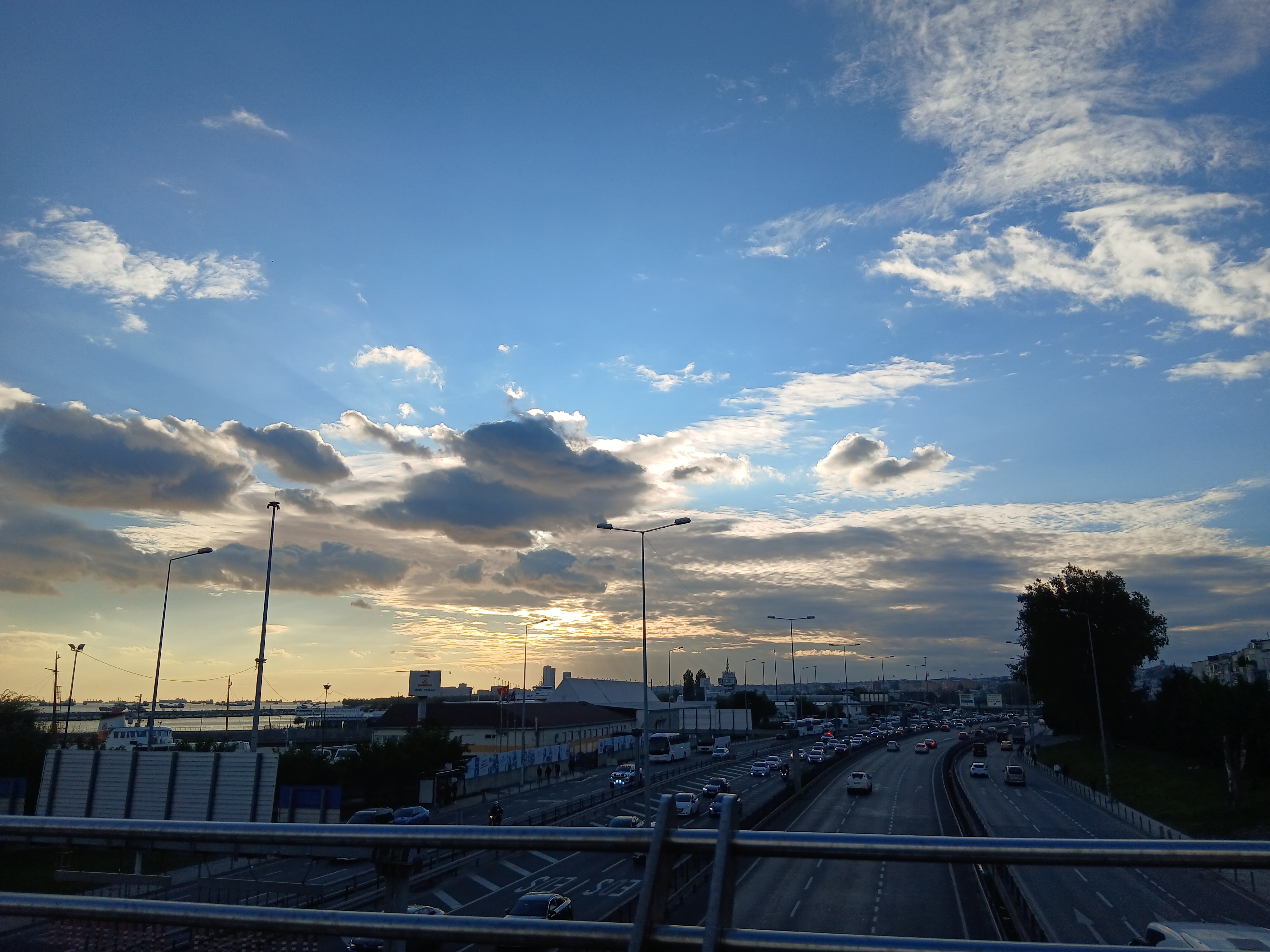
The image displays a multi-lane highway with heavy traffic, an adjacent lower road, and a body of water with numerous large ships anchored in the distance. To the left, there is a building with a prominent sign.
Upon close inspection of the cropped image, the sign clearly shows 'ŞEHİR HATLARI' (City Lines) and partially 'İSTANBUL', which refers to Istanbul's public ferry service. Another visible text on the road markings is 'OTOBÜS YOLU', meaning 'BUS LANE' in Turkish.
These two pieces of textual evidence definitively place the location in Istanbul, Turkey. The presence of many anchored ships is characteristic of the Marmara Sea near the entrance to the Bosphorus, a major shipping route.
The architecture and urban density are consistent with Istanbul. The specific combination of a major highway (D100/E5), a ferry terminal (Şehir Hatları), and a bus terminal (Harem Otogarı) in close proximity, with a view over the Marmara Sea, strongly points to the Harem area in Üsküdar, on the Asian side of Istanbul.
The viewpoint appears to be from the Harem Pedestrian Overpass (Harem Yaya Üst Geçidi), looking southwest over the D100 highway towards the Harem Ferry Terminal and the sea. The sunset/sunrise lighting over the water further supports this orientation.
The image shows a large coastal highway with multiple lanes and heavy traffic, typical of a major metropolitan area. The presence of port cranes and ships indicates proximity to a significant port.
The architecture and road infrastructure, along with the style of street lamps and vehicles, suggest a European-Asian transcontinental city. The sunset direction and coastal layout match the northern shore of the Sea of Marmara.
This is consistent with the highway near the Haydarpaşa Port area in Istanbul, Turkey. The visible urban density and port infrastructure strongly support this location.
The image shows a large coastal highway with multiple lanes and heavy traffic, typical of a major metropolitan area. The presence of port cranes and ships indicates proximity to a significant port. The architecture and road infrastructure, along with the style of street lamps and vehicles, suggest a European-Asian transcontinental city. The sunset direction and coastal layout match the northern shore of the Sea of Marmara. This is consistent with the highway near the Haydarpaşa Port area in Istanbul, Turkey. The visible urban density and port infrastructure strongly support this location.
🗺 En el mapa
 высокая уверенность
•
высокая уверенность
•
 средняя
•
средняя
•
 низкая
Cómo llegó la IA a esta conclusión
Entorno
Coastal urban area with distant hills • Sparse urban trees • Temperate, likely Mediterranean/continental blend • Coastal urban • Sparse trees and shrubs • Temperate, maritime
Infraestructura
White dashed and solid lines, 'OTOBÜS YOLU' text, typical Turkish style • Large billboard with 'ŞEHİR HATLARI' and 'İSTANBUL' text, smaller signs • Mix of modern highway infrastructure, port buildings, and distant residential blocks • Multiple lane highway, solid and dashed lines • None clearly visible • Mid-rise urban buildings, port cranes
Texto y señales visibles
ŞEHİR HATLARI • İSTANBUL • OTOBÜS YOLU • AYAZMA
Contexto y cultura
Cars, buses, motorcycles, cargo ships/tankers • Not clearly visible, but vehicle types are consistent with Turkey • Passenger cars, motorcycles • Not clearly visible