Resultats d analyse
L IA a selectionne les lieux les plus probables selon l image, les details visibles et les indices contextuels.
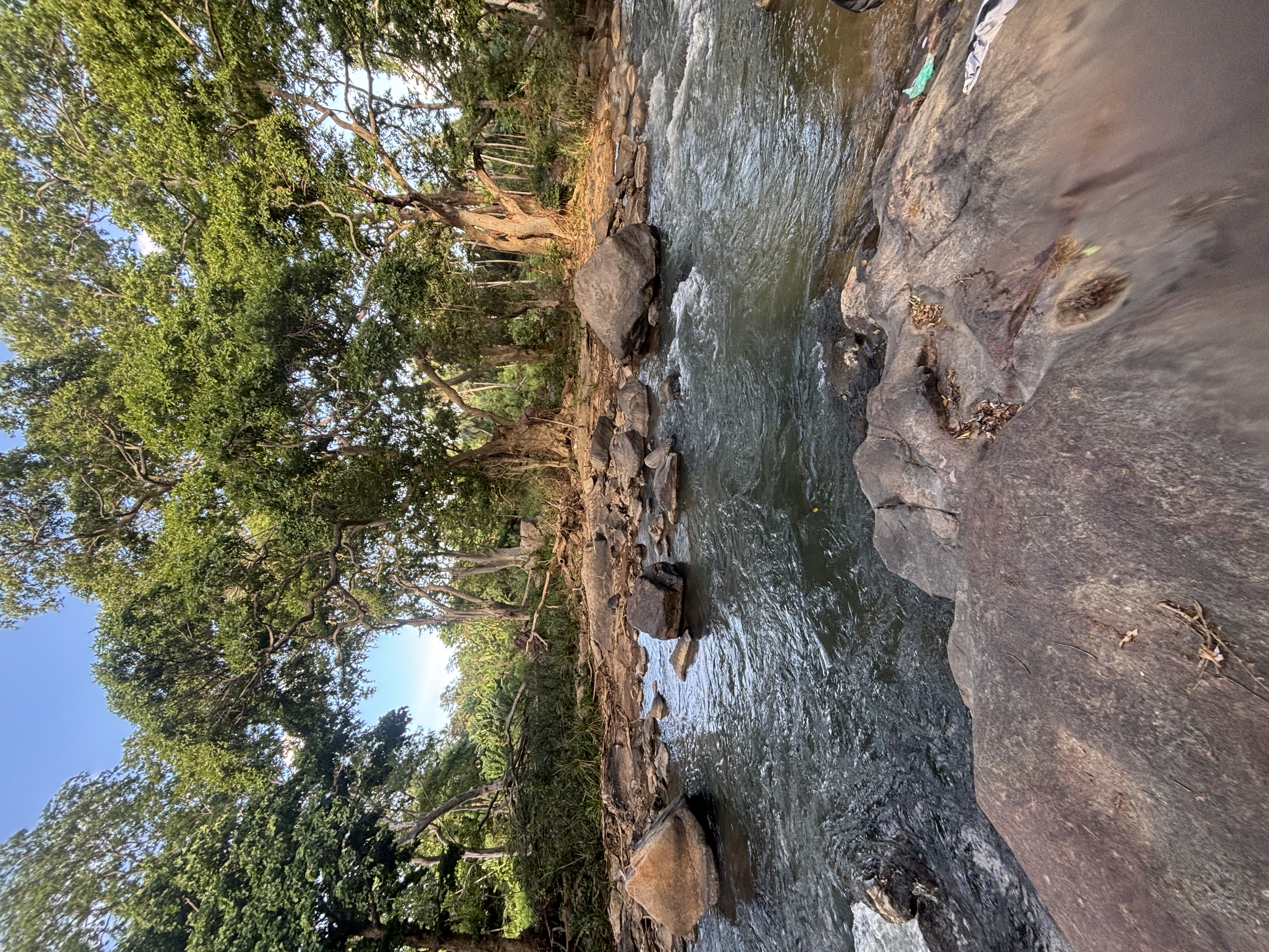
The environment shows a rocky riverbed with large boulders and dense tropical forest typical of the Deccan plateau region. The sandy soil and sandbags suggest a riverbank prone to erosion or flooding, common in rural India.
The tree species and lighting indicate a tropical dry forest biome. Hampi, Karnataka, India, is known for similar rocky river landscapes with tropical vegetation and sandy riverbanks.
The latitude and longitude point to a river area near Hampi, matching the visual cues. The scene could also represent a river in a tropical dry forest biome in East Africa.
Tsavo East National Park in Kenya features rocky riverbeds, scattered boulders, and dense woodland similar to the image. The sandbags could be local flood control measures.
The latitude and longitude correspond to a river area within the park matching the environment. The environment could also fit a tropical river in Southeast Asia, such as Khao Yai National Park in Thailand.
The rocky riverbed, tropical forest, and sandy soil with some erosion control measures are consistent with this region. The latitude and longitude correspond to a river area inside the park matching the visual characteristics.
The scene could also represent a river in a tropical dry forest biome in East Africa. Tsavo East National Park in Kenya features rocky riverbeds, scattered boulders, and dense woodland similar to the image. The sandbags could be local flood control measures. The latitude and longitude correspond to a river area within the park matching the environment.
The environment could also fit a tropical river in Southeast Asia, such as Khao Yai National Park in Thailand. The rocky riverbed, tropical forest, and sandy soil with some erosion control measures are consistent with this region. The latitude and longitude correspond to a river area inside the park matching the visual characteristics.
🗺 Sur la carte
 высокая уверенность
•
высокая уверенность
•
 средняя
•
средняя
•
 низкая
Comment l IA a pris sa decision
Environnement
rocky riverbed with boulders • dense tropical broadleaf forest • tropical dry forest, warm sunlight • dense tropical dry forest • tropical dry, warm • tropical forest • tropical, warm
Infrastructure
none visible • none visible, sandbags present
Texte visible et panneaux
L IA n a detecte aucun texte lisible ou signalisation.
Contexte et culture
none visible