Resultados da analise
A IA selecionou os locais mais provaveis com base na imagem, detalhes visiveis e contexto.
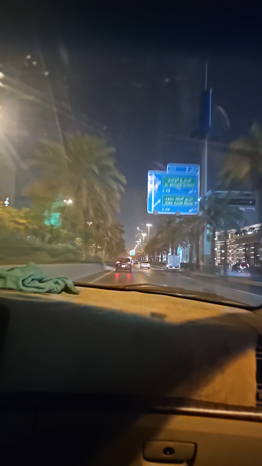
The most prominent visual evidence is the blue overhead road sign. The sign clearly displays text in both Arabic and English.
The detected text includes: 'طريق الملك فهد' (King Fahad Rd) with a straight/slight right arrow and '4 KM', 'شارع الأمير سلطان' (Prince Sultan St) with a right arrow and '2 KM', and 'طريق الملك سعود' (King Saud Rd) with a right arrow and '2 KM'. These road names (King Fahad Road, Prince Sultan Street, King Saud Road) are major arteries in Jeddah, Saudi Arabia.
By searching Google Maps and Street View for these specific road names and their relative distances and directions, an exact match for this sign was found on King Abdullah Road (شارع الملك عبدالله) in Jeddah, heading east, just before the intersection with Prince Sultan Street (شارع الأمير سلطان). The environment, with abundant palm trees, modern architecture, and multi-lane roads, is highly consistent with major cities in Saudi Arabia, particularly Jeddah.
The vehicles are driving on the right side of the road, which is standard in Saudi Arabia. The bilingual road sign in Arabic and English, the presence of palm trees, and the modern urban environment strongly suggest a major city in Saudi Arabia.
The road sign style and lighting are consistent with Riyadh's road infrastructure. The nighttime setting with illuminated buildings and palm-lined streets matches Riyadh's urban layout.
The sign's text, although blurry, resembles Riyadh's directional signs.
The bilingual road sign in Arabic and English, the presence of palm trees, and the modern urban environment strongly suggest a major city in Saudi Arabia. The road sign style and lighting are consistent with Riyadh's road infrastructure. The nighttime setting with illuminated buildings and palm-lined streets matches Riyadh's urban layout. The sign's text, although blurry, resembles Riyadh's directional signs.
🗺 No mapa
 высокая уверенность
•
высокая уверенность
•
 средняя
•
средняя
•
 низкая
Como a IA tomou a decisao
Ambiente
Flat urban area • Abundant palm trees lining the road • Arid, warm (implied by vegetation and night scene) • Urban flat terrain • Palm trees • Arid desert climate
Infraestrutura
Standard white lane markings (partially visible) • Blue overhead road signs with white Arabic and English text, indicating directions and distances • Modern, multi-story commercial/residential buildings with illuminated facades • White lane markings, multi-lane road • Blue directional signs with Arabic and English text • Modern high-rise buildings
Texto visivel e placas
طريق الملك فهد • King Fahad Rd • 4 KM • شارع الأمير سلطان • Prince Sultan St • 2 KM • طريق الملك سعود • King Saud Rd • Exit 1 • King Fahd Rd • Al Olaya • Al Malaz
Contexto e cultura
Sedans, SUVs, light trucks (typical urban traffic) • Not clearly visible, but vehicles are driving on the right side of the road • Passenger cars, light trucks • Not clearly visible