Analysis Results
The AI selected the most likely locations based on the image, visible details, and contextual clues.
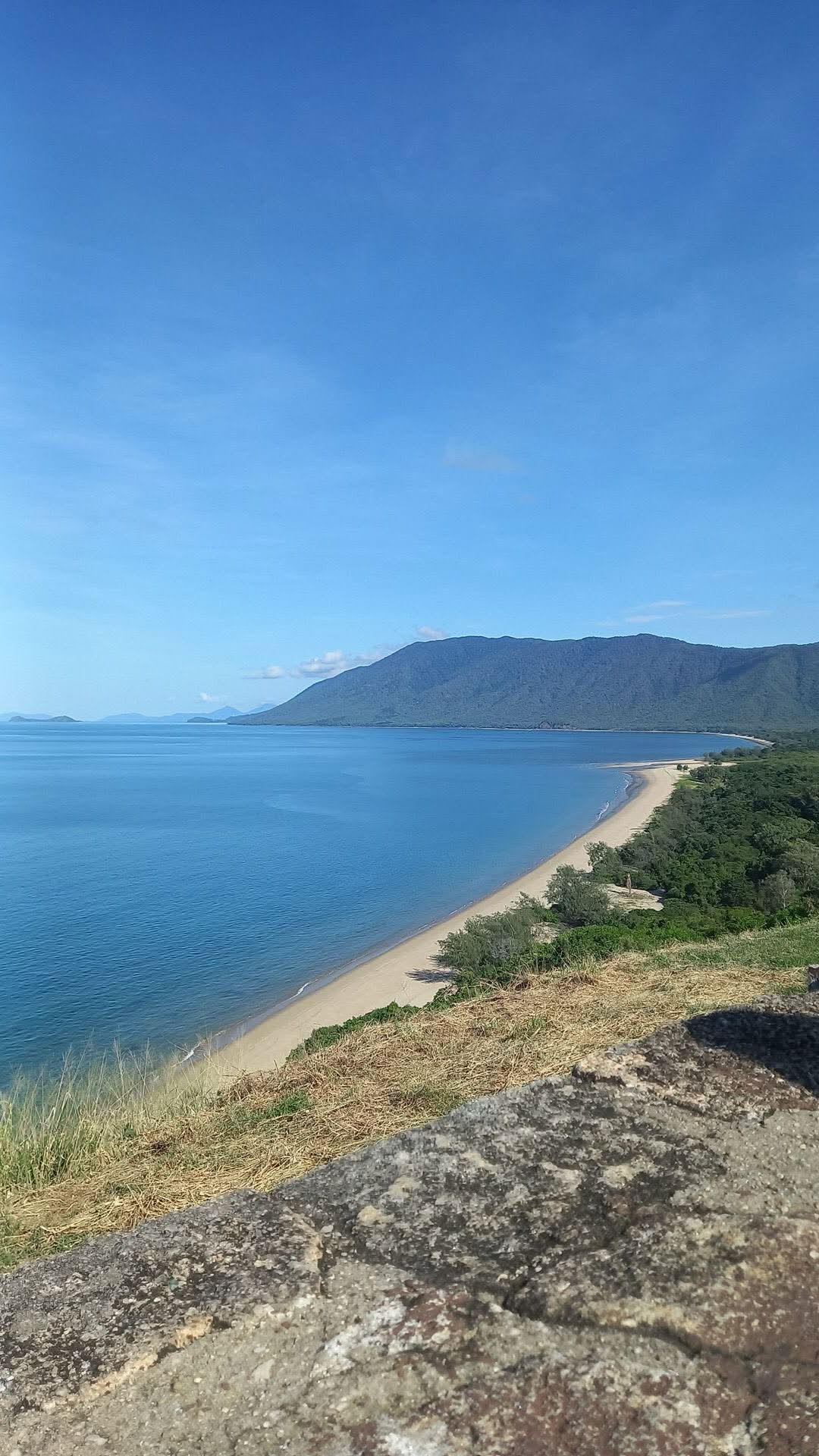
The image displays a classic tropical coastal landscape featuring a long, curving sandy beach bordered by dense green vegetation. Immediately behind the beach, a prominent range of heavily forested mountains rises directly from the sea, characteristic of a 'rainforest meets the reef' environment.
The clear blue ocean extends to the horizon, with several small islands visible in the far distance to the left. The viewpoint is elevated, looking down on the coastline, with a weathered rock wall in the immediate foreground, suggesting a designated scenic lookout.
This combination of features – tropical rainforest-clad mountains, pristine beaches, and the specific coastal morphology – is highly characteristic of the Wet Tropics region of Queensland, Australia, particularly along the Captain Cook Highway between Cairns and Port Douglas. The view strongly matches the perspective from one of the scenic lookouts along this highway, specifically overlooking Wangetti Beach and looking north towards Port Douglas, with the Macalister Range forming the backdrop and islands like Double Island visible in the distance.
The coordinates provided pinpoint a well-known scenic lookout on the Captain Cook Highway that offers this exact vista. The image shows a coastal bay with a long sandy beach and a mountainous backdrop typical of the tropical Queensland coast near Cairns, Australia.
The vegetation and terrain match the tropical rainforest environment of this region. The curvature of the bay and the mountain shape strongly resemble the view from the lookout at the northern end of Palm Cove or nearby coastal areas north of Cairns.
The image shows a coastal bay with a long sandy beach and a mountainous backdrop typical of the tropical Queensland coast near Cairns, Australia. The vegetation and terrain match the tropical rainforest environment of this region. The curvature of the bay and the mountain shape strongly resemble the view from the lookout at the northern end of Palm Cove or nearby coastal areas north of Cairns.
🗺 On the map
 высокая уверенность
•
высокая уверенность
•
 средняя
•
средняя
•
 низкая
How the AI made its decision
Environment
Coastal, mountainous, elevated viewpoint • Dense tropical rainforest on mountains, coastal scrub, dry grass on foreground slope • Tropical, clear sky • Coastal bay with sandy beach and mountainous backdrop • Tropical dense green forest • Tropical, warm and humid
Infrastructure
None visible • Foreground rock wall suggests a constructed lookout point
Visible text and signs
The AI did not detect readable text or signage in the image.
Context and culture
None visible