Analysis Results
The AI selected the most likely locations based on the image, visible details, and contextual clues.
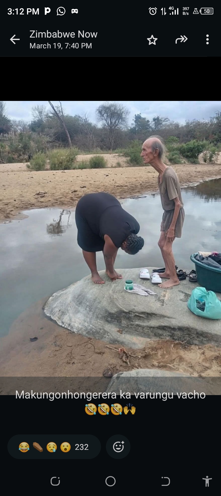
The most compelling evidence is the text overlay 'Zimbabwe Now' and the Shona phrase 'Makungonhongerera ka varungu vacho'. Shona is a major language in Zimbabwe, and 'Zimbabwe Now' strongly indicates the country of origin or relevance.
Visually, the scene depicts a shallow river with sandy banks and exposed bedrock, surrounded by sparse, dry-looking trees and bushes. This environment is highly characteristic of many rural river systems in Zimbabwe, particularly in regions like Matabeleland South, which features granite outcrops and seasonal rivers.
The Mzingwane River in Matabeleland South is a representative example of such a river, with wide sandy beds and exposed rock formations, consistent with the visual evidence. The activity of washing or gathering by the river is also common in rural areas of Zimbabwe.
Similar to the primary candidate, the textual evidence unequivocally points to Zimbabwe. The visual environment of a sandy river with exposed rocks and sparse vegetation is also highly consistent with the Save River in Manicaland Province.
The Save River is a major watercourse in eastern Zimbabwe, flowing through areas with similar ecological characteristics. This location represents another plausible rural river setting within Zimbabwe that matches the generic visual cues.
The strong textual evidence for Zimbabwe is the primary determinant. The Mazowe River, flowing through Mashonaland Central, presents another viable location that aligns with the visual characteristics.
This region also features rural landscapes with rivers that have sandy banks and exposed rock formations, especially during periods of lower water levels. While the specific visual details are not unique enough to pinpoint one river over another, the Mazowe River offers a geographically distinct yet equally plausible setting within Zimbabwe.
Similar to the primary candidate, the textual evidence unequivocally points to Zimbabwe. The visual environment of a sandy river with exposed rocks and sparse vegetation is also highly consistent with the Save River in Manicaland Province. The Save River is a major watercourse in eastern Zimbabwe, flowing through areas with similar ecological characteristics. This location represents another plausible rural river setting within Zimbabwe that matches the generic visual cues.
The strong textual evidence for Zimbabwe is the primary determinant. The Mazowe River, flowing through Mashonaland Central, presents another viable location that aligns with the visual characteristics. This region also features rural landscapes with rivers that have sandy banks and exposed rock formations, especially during periods of lower water levels. While the specific visual details are not unique enough to pinpoint one river over another, the Mazowe River offers a geographically distinct yet equally plausible setting within Zimbabwe.
🗺 On the map
 высокая уверенность
•
высокая уверенность
•
 средняя
•
средняя
•
 низкая
How the AI made its decision
Environment
Sandy riverbed, exposed large smooth rocks, gentle river flow • Sparse, dry-looking trees and bushes typical of savanna/semi-arid climate • Semi-arid to sub-humid, likely dry season conditions
Infrastructure
No infrastructure-specific details were saved for this result.
Visible text and signs
Zimbabwe Now • Makungonhongerera ka varungu vacho
Context and culture
The most compelling evidence is the text overlay 'Zimbabwe Now' and the Shona phrase 'Makungonhongerera ka varungu vacho'. Shona is a major language in Zimbabwe, and 'Zimbabwe Now' strongly indicates the country of origin or relevance. Visually, the scene depicts a shallow river with sandy banks and exposed bedrock, surrounded by sparse, dry-looking trees and bushes. This environment is highly characteristic of many rural river systems in Zimbabwe, particularly in regions like Matabeleland South, which features granite outcrops and seasonal rivers. The Mzingwane River in Matabeleland South is a representative example of such a river, with wide sandy beds and exposed rock formations, consistent with the visual evidence. The activity of washing or gathering by the river is also common in rural areas of Zimbabwe. Similar to the primary candidate, the textual evidence unequivocally points to Zimbabwe. The visual environment of a sandy river with exposed rocks and sparse vegetation is also highly consistent with the Save River in Manicaland Province. The Save River is a major watercourse in eastern Zimbabwe, flowing through areas with similar ecological characteristics. This location represents another plausible rural river setting within Zimbabwe that matches the generic visual cues. The strong textual evidence for Zimbabwe is the primary determinant. The Mazowe River, flowing through Mashonaland Central, presents another viable location that aligns with the visual characteristics. This region also features rural landscapes with rivers that have sandy banks and exposed rock formations, especially during periods of lower water levels. While the specific visual details are not unique enough to pinpoint one river over another, the Mazowe River offers a geographically distinct yet equally plausible setting within Zimbabwe.