Resultados da analise
A IA selecionou os locais mais provaveis com base na imagem, detalhes visiveis e contexto.
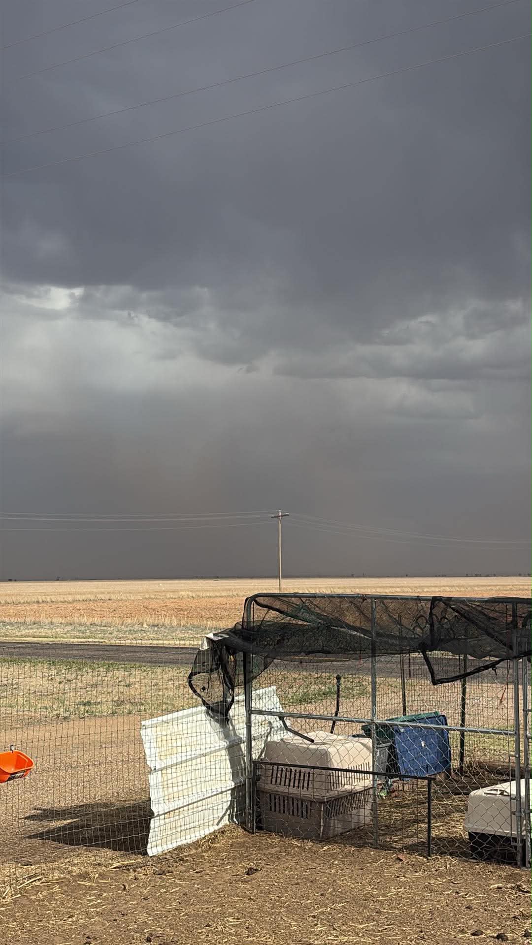
The image displays an extremely flat, expansive landscape dominated by dry, harvested or fallow agricultural fields. The most striking feature is the dark, ominous sky with a distinct wall of dust obscuring the horizon, characteristic of a severe dust storm or haboob.
This environmental combination, along with the wooden utility pole and rural paved road, strongly points to the Great Plains region of the United States, particularly the Texas Panhandle, which is historically and currently known for such conditions and landscape. Similar to the Texas Panhandle, western Oklahoma exhibits a very flat, agricultural landscape that is highly susceptible to severe weather phenomena, including dust storms.
The visual evidence of dry fields, a rural road, and an approaching haboob aligns perfectly with the geography and climate of this region within the Great Plains. The landscape is a flat, dry agricultural plain with power lines and fencing typical of rural farming areas in the Central Valley of California, USA.
The soil and vegetation suggest a semi-arid climate. The fencing and crates indicate animal farming or poultry.
The stormy sky is consistent with weather patterns in this region. No specific landmark is visible, so the best precision is a district-level guess in Central California's Central Valley.
Eastern Colorado is another part of the vast Great Plains, characterized by its flat terrain and extensive agricultural activity. This region also experiences periods of drought and high winds, making dust storms a known occurrence.
The scene's overall environmental and infrastructural elements are consistent with a rural area in eastern Colorado.
Similar to the Texas Panhandle, western Oklahoma exhibits a very flat, agricultural landscape that is highly susceptible to severe weather phenomena, including dust storms. The visual evidence of dry fields, a rural road, and an approaching haboob aligns perfectly with the geography and climate of this region within the Great Plains.
The landscape is a flat, dry agricultural plain with power lines and fencing typical of rural farming areas in the Central Valley of California, USA. The soil and vegetation suggest a semi-arid climate. The fencing and crates indicate animal farming or poultry. The stormy sky is consistent with weather patterns in this region. No specific landmark is visible, so the best precision is a district-level guess in Central California's Central Valley.
Eastern Colorado is another part of the vast Great Plains, characterized by its flat terrain and extensive agricultural activity. This region also experiences periods of drought and high winds, making dust storms a known occurrence. The scene's overall environmental and infrastructural elements are consistent with a rural area in eastern Colorado.
🗺 No mapa
 высокая уверенность
•
высокая уверенность
•
 средняя
•
средняя
•
 низкая
Como a IA tomou a decisao
Ambiente
Flat plains, agricultural fields • Sparse dry grass, harvested/fallow crops • Arid/semi-arid, prone to dust storms • flat agricultural plain • dry grass and sparse vegetation • semi-arid, stormy
Infraestrutura
Not visible, but a paved road is present • None visible • Wire fence, animal enclosure, wooden utility pole • rural fencing and animal crates
Texto visivel e placas
A IA nao detectou texto legivel ou sinalizacao na imagem.
Contexto e cultura
None visible