Resultados da analise
A IA selecionou os locais mais provaveis com base na imagem, detalhes visiveis e contexto.
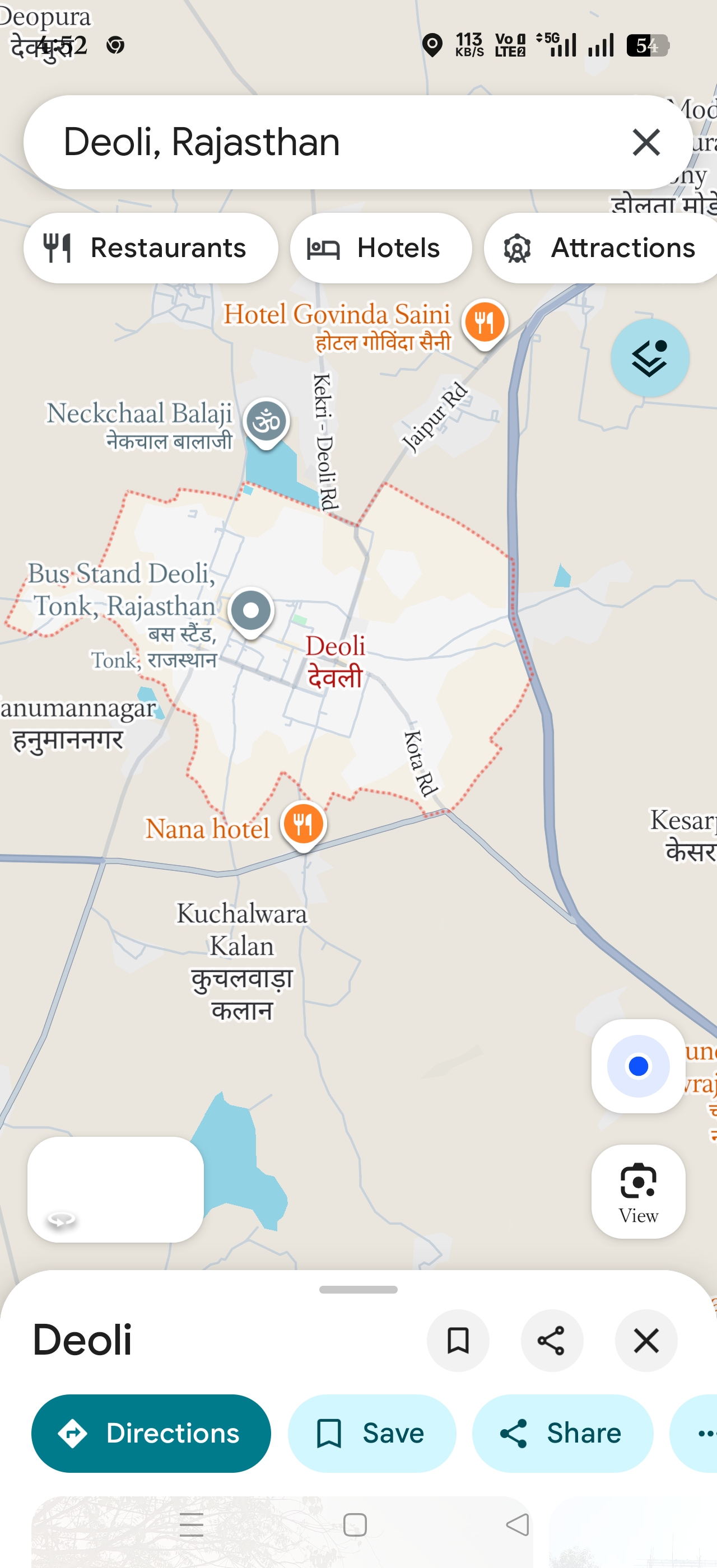
The map clearly shows the town of Deoli in Rajasthan, India, with marked boundaries and key local landmarks such as the Bus Stand Deoli and Hotel Govinda Saini. The road names (Jaipur Rd, Kota Rd) and nearby villages like Kuchalwara Kalan confirm the location within Tonk district, Rajasthan.
This is a precise district-level location with visible town layout. Hanumannagar is a nearby settlement southwest of Deoli visible on the map.
It shares similar geographic and infrastructural characteristics but is a distinct locality. This is a reasonable alternative district-level guess within the same region.
Kuchalwara Kalan is a village south of Deoli shown on the map. It is a smaller settlement but within the same district and region.
This is a lower confidence alternative guess based on proximity and map context.
Hanumannagar is a nearby settlement southwest of Deoli visible on the map. It shares similar geographic and infrastructural characteristics but is a distinct locality. This is a reasonable alternative district-level guess within the same region.
Kuchalwara Kalan is a village south of Deoli shown on the map. It is a smaller settlement but within the same district and region. This is a lower confidence alternative guess based on proximity and map context.
🗺 No mapa
 высокая уверенность
•
высокая уверенность
•
 средняя
•
средняя
•
 низкая
Como a IA tomou a decisao
Ambiente
Flat terrain with small water bodies nearby • Sparse vegetation typical of semi-arid Rajasthan • Semi-arid climate • Flat terrain • Sparse vegetation • Semi-arid
Infraestrutura
Main roads connecting to Jaipur and Kota • Local place names in Hindi and English • Not visible in map, typical small town layout • Local roads • Hindi text • Small town • Village structures
Texto visivel e placas
Deoli, Rajasthan • Bus Stand Deoli, Tonk, Rajasthan • Hotel Govinda Saini • Nana hotel • Neckchaal Balaji • Hanumannagar • Kuchalwara Kalan
Contexto e cultura
Not visible