Analyseergebnisse
Die KI hat anhand des Bildes, sichtbarer Details und kontextueller Hinweise die wahrscheinlichsten Orte gewaehlt.
The second image displays a vast system of powerful waterfalls plunging into a gorge, surrounded by dense rainforest. This scale, layout, and environment are the unmistakable characteristics of Iguazu Falls, located on the border of Brazil and Argentina.
The specific U-shaped chasm is highly indicative of the section known as the 'Devil's Throat' (Garganta del Diablo). The coordinates point to a popular viewpoint on the Brazilian side offering a panoramic view of this feature.
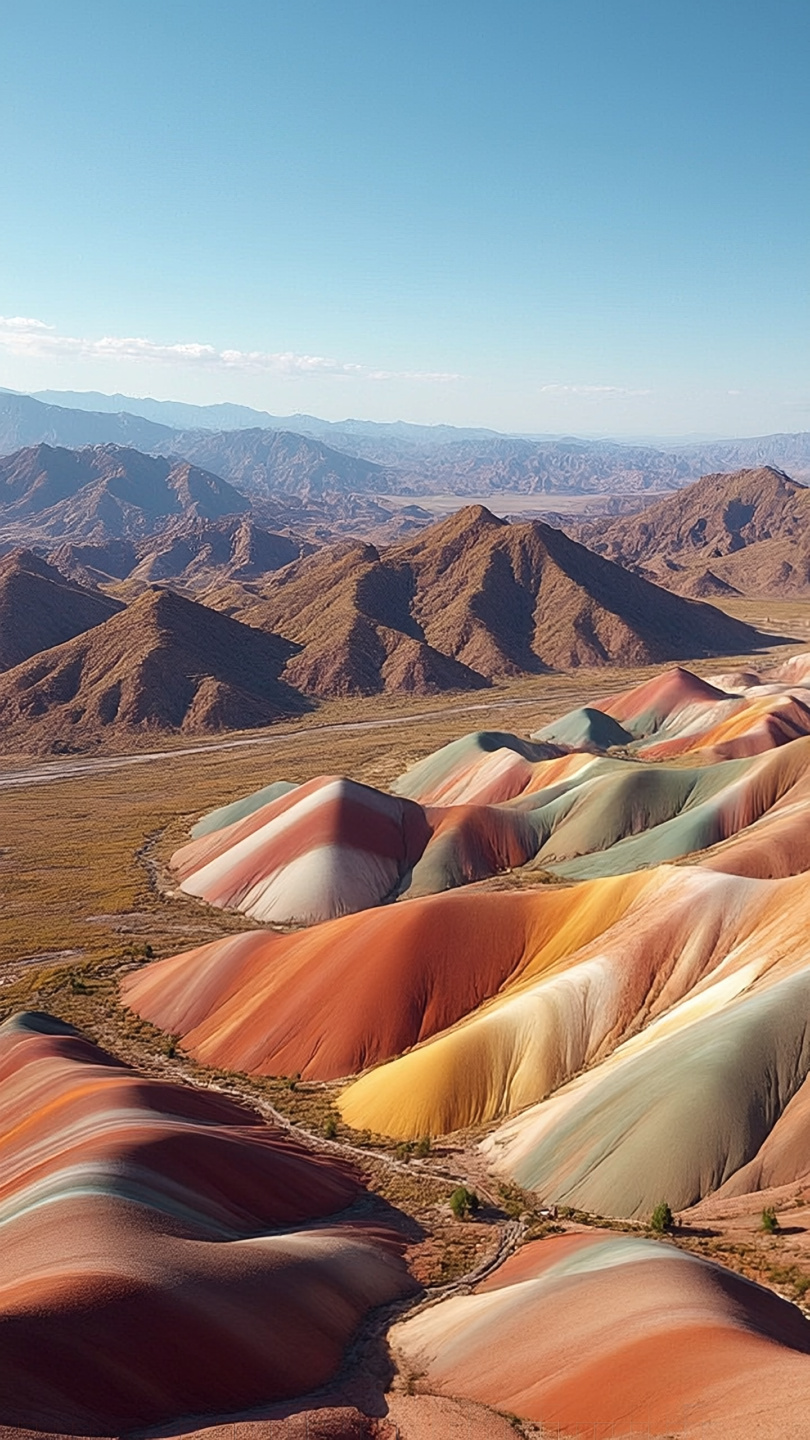
The first image shows the unique Danxia landforms, characterized by multicolored, striped rock layers that resemble a rainbow. This geological formation is the defining feature of the Zhangye National Geopark in Gansu Province, China.
The arid environment, the shape of the hills, and the surrounding brownish mountains are all perfectly consistent with this specific location. The first image shows the famous Zhangye Danxia Landform Geological Park in Gansu Province, China.
The unique colorful rock formations with red, orange, yellow, and green stripes are iconic and globally recognized. The arid mountainous terrain in the background matches the region's geography.
The third image features a unique, gnarled tree with a twisted trunk and prominent roots, set against a backdrop of an arid coastline with turquoise water. This combination of endemic flora (resembling a Bottle Tree, Boswellia, or Commiphora species) and landscape is iconic and almost exclusive to Socotra Island, Yemen.
The scene is highly characteristic of areas like Qalansiyah Beach or the adjacent Detwah Lagoon. While the specific tree may be an idealized or AI-generated composite, the location it represents is unmistakably Socotra.
The first image shows the unique Danxia landforms, characterized by multicolored, striped rock layers that resemble a rainbow. This geological formation is the defining feature of the Zhangye National Geopark in Gansu Province, China. The arid environment, the shape of the hills, and the surrounding brownish mountains are all perfectly consistent with this specific location.
The first image shows the famous Zhangye Danxia Landform Geological Park in Gansu Province, China. The unique colorful rock formations with red, orange, yellow, and green stripes are iconic and globally recognized. The arid mountainous terrain in the background matches the region's geography.
The third image features a unique, gnarled tree with a twisted trunk and prominent roots, set against a backdrop of an arid coastline with turquoise water. This combination of endemic flora (resembling a Bottle Tree, Boswellia, or Commiphora species) and landscape is iconic and almost exclusive to Socotra Island, Yemen. The scene is highly characteristic of areas like Qalansiyah Beach or the adjacent Detwah Lagoon. While the specific tree may be an idealized or AI-generated composite, the location it represents is unmistakably Socotra.
🗺 Auf der Karte
 высокая уверенность
•
высокая уверенность
•
 средняя
•
средняя
•
 низкая
Wie die KI ihre Entscheidung getroffen hat
Umgebung
Gorge, Cliff, River • Dense rainforest, Tropical • Humid subtropical • Danxia landform, Hills, Arid mountains • Sparse, Arid scrubland • Arid, Continental • Arid, mountainous, rocky • Sparse desert shrubs • Dry, semi-arid • Coastal, Arid hills, Sandy beach • Endemic arid-adapted trees, Scrubland • Arid, Tropical
Infrastruktur
Keine infrastrukturspezifischen Details fuer dieses Ergebnis gespeichert.
Sichtbarer Text und Schilder
Die KI hat keinen lesbaren Text oder Beschilderung erkannt.
Kontext und Kultur
The second image displays a vast system of powerful waterfalls plunging into a gorge, surrounded by dense rainforest. This scale, layout, and environment are the unmistakable characteristics of Iguazu Falls, located on the border of Brazil and Argentina. The specific U-shaped chasm is highly indicative of the section known as the 'Devil's Throat' (Garganta del Diablo). The coordinates point to a popular viewpoint on the Brazilian side offering a panoramic view of this feature. The first image shows the unique Danxia landforms, characterized by multicolored, striped rock layers that resemble a rainbow. This geological formation is the defining feature of the Zhangye National Geopark in Gansu Province, China. The arid environment, the shape of the hills, and the surrounding brownish mountains are all perfectly consistent with this specific location. The first image shows the famous Zhangye Danxia Landform Geological Park in Gansu Province, China. The unique colorful rock formations with red, orange, yellow, and green stripes are iconic and globally recognized. The arid mountainous terrain in the background matches the region's geography. The third image features a unique, gnarled tree with a twisted trunk and prominent roots, set against a backdrop of an arid coastline with turquoise water. This combination of endemic flora (resembling a Bottle Tree, Boswellia, or Commiphora species) and landscape is iconic and almost exclusive to Socotra Island, Yemen. The scene is highly characteristic of areas like Qalansiyah Beach or the adjacent Detwah Lagoon. While the specific tree may be an idealized or AI-generated composite, the location it represents is unmistakably Socotra.